Mount Toubkal Winter Climb
Climb Mt Toubkal 4167m :: North Africa's highest mountain :: North
Africa's highest mountain

Tour merken!
|
|
|
|
|
|
Day 1: After a transfer to the little village of Imlil we begin our trek. Heading along the Mizane Valley, we first pass the village of Aremd and then onto the shrine of Sidi Chamarouch. We then continue east and by crossing the flood plains our route takes us along mule tracks and up into the high rocky cliffs above the valley. Crossing the river we eventually come to the pastoral shrine of Sidi Chamarouch, which attracts tourists and pilgrims. From here the trail continues to climb steadily, snaking and zigzagging its way up to the snowline and the Toukbal Refuge (3206m), our stop for the night.
Approx. 4 to 5hrs walking.
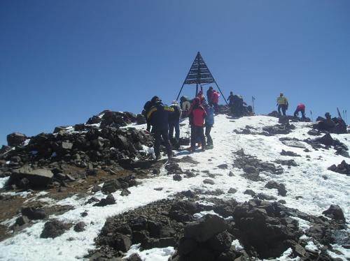
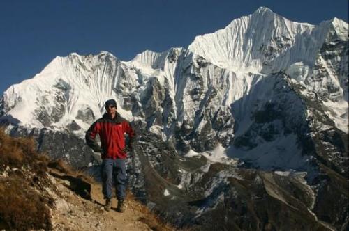
Day 2: Early in the morning we make our attempt on the summit of Jebel Toukbal, the highest peak in Northern Africa. Our route takes us up the south cirque, crossing the stream above the refuge. The walking is relatively straightforward, but the scree and the altitude will make the going quite difficult in parts. The views along the way make the journey more than worthwhile. When you reach the the summit you will see that the vistas across the surrounding landscape are quite breathtaking. From here there are unrestricted views in every direction, from the Marrakesh Plain to the High Atlas in the north and as far south as the Anti-Atlas and the Sahara. We will retrace our steps when we return down the mountain and head back to the Toubkal Refuge where we will spend the night.
Day 3: Today we walk back from the Toubkal Refuge to Imlil. After arrival in Imlil we will transfer back to Marrakech.
terms & privacy policy
Bitte wende dich an den Guide um nähere Informationen zu den allgemeinen Geschäftsbedingungen zu erhalten
Route
 | This is a wonderful winter break to Climb Mt toubkal in Winter the spectacular Mount in the high Atlas of Morocco in North Africa in Winter Conditions. |
Das könnte dich auch interessieren:
|
|
|
Day 1: After a transfer to the little village of Imlil we begin our trek. Heading along the Mizane Valley, we first pass the village of Aremd and then onto the shrine of Sidi Chamarouch. We then continue east and by c... | |
| |
|
|
The French explorer Emmanuel de Martonne has named F?g?ras mountains, the Alps of Transylvania, a stretch of peaks, holes and saddles which are scattered on an area of around 2.400 km². If you come in Romania for... | |
| |
|
|
Retezat Mountains, natural rezervation park since 1931 is something different among the Romanian Mountains.Possessing typical glacial relief, with valleys, lakes and glacial domes, but also many gorges, caves and clif... | |
| |
|
|
Paring Mountains - Buila Vinturarita rises like a mighty fortress (alt. max. Vf. Paringu Great 2519m) over Petrosani depression and Jiu Gorge. Central slopes surrounding two huge buckets that are nesting glacial lakes... | |
| |


 5
5
 3
3